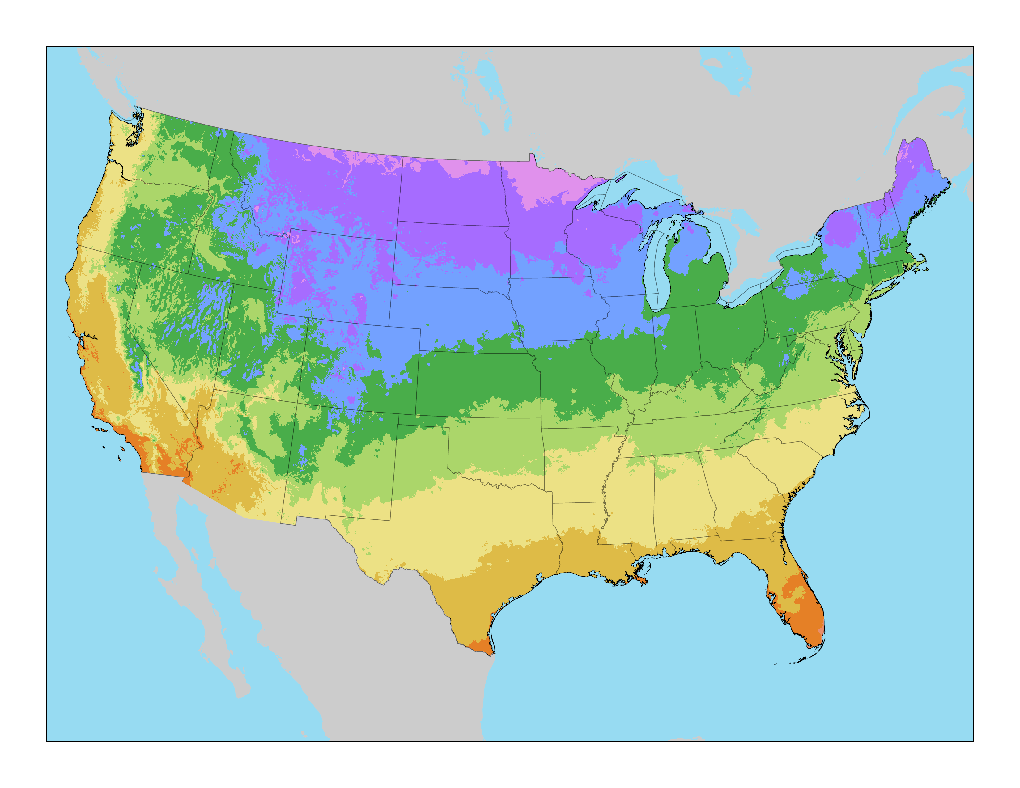
The USDA Plant Hardiness Zone Map is the standard by which gardeners and growers can determine which perennial plants are most likely to thrive at a location. The map is based on the average annual extreme minimum winter temperature, displayed as 10°F zones and 5°F half zones.
The U.S. hardiness zone map illustrates how cold a geographic area is and to provide indications of how well plants are able to survive cold temperatures in these locations. In the U.S., hardiness zones are based on the average annual extreme minimum temperatures over a 30-year period in the past, not the lowest temperature that has ever occurred in the past or might occur in the future. The zones indicate the lowest average temperatures an area can expect each year.

Offering annuals, perennials, accent plants, hanging baskets and other planted containers from the greenhouse in Deer Lodge, Montana. Trees and shrubs, as well as other specialty plants, including garden hard goods are available depending upon season.